Saturday, September 30, 2006

Brownsea Island from the water!


Technorati Profile

Thursday, September 28, 2006

Chessil Beach


Unbelievable as it may seem this picture was taken while standing in the carpark! As you rightly guessed it was a wet day, and I am stood in the carpark located next to the Heritage Centre! Not a lot of visitors to Chessil that day

In the distance you can see the mound of pebbles which is Chessil beach!

Monday, September 25, 2006

Back to Lulworth Stairhole!


Another picture of the Lulworth Stairhole ... also known as the Lulworth Crumple! What you see is another cove being created next to Lulworth Cove. The breach has been made by collapsinig caves and arches. This has revealed the famous Lulworth Crumple, a complex fold formed by major earth movements that occurred in the same period that the Alps were formed.

[Courtesy of The Official Guide to the Jurassic Coast]

The rocks in this area are from the jurassic and Cretatious era, which are from 65 million to a little over 140 million years ago

Tuesday, September 19, 2006

Old Harry's Rock

I visited this rock formation way back in the summer, viewing it from the sea!


The rocks are caused by the erosion of waves, which attack the weak joints in the rock, forming arches and caves. Eventually they collapse leaving isolated stacks like 'Old harry'.

The rocks in this area are chalk from the Cretatious era of around 65 million years ago

Tuesday, September 12, 2006

The Cliffs between Durdle Door and Lulworth Cove

Sunday, September 10, 2006

Durdle Door


The picture above is of a pathway I descended from a car park, just off the road that leads to Lulworth Cove, which is a mile or so from Durdle Door. At the edge of one the chalkstone cliffs at the end of the windy path I could see more chalkstone cliffs to the right and left


Looking out to sea and below the cliff edge I was stood on, at the foot of the long windy path is Durdle Door. It is a perfect coastal arch, carved out, by the erosive action of the sea

The rocks in this area are of chalk, from the Cretatious Period of approximately 65 million years ago

Tuesday, September 05, 2006

Gateway Towns - Portland

Although the Jurassic coast is approximately 95 miles long, it is but a few yards wide, reaching up to the edges of the beachs, coastline and cliffs, therefore just a few yards wide in some locations. Bearing that in mind, there are a number of other features lying just beyond the boundary of the Jurassic coast. For example there are a number of what are named gateway towns lying just behind the boundary ... there are also castles and other buildings of historical importance. One such building is Portland castle, as shown below ...


Portland castle was built by Henry VIII in 1540. Forming part of his coastal defense system against invasion by the French. Positioned so close to the enemy across the narrow channel, he took no chances and built the castle walls fourteen feet thick

Saturday, September 02, 2006

Brownsea Island


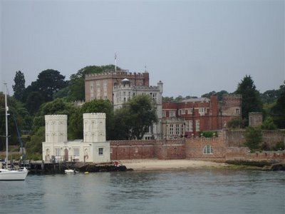
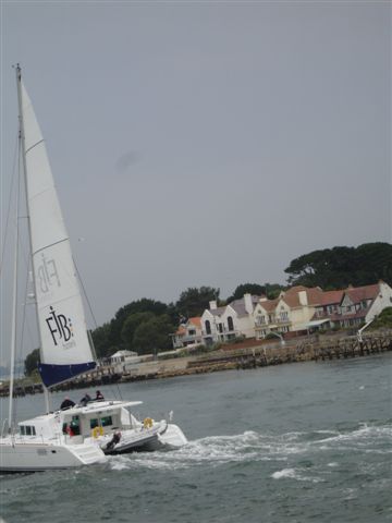
I saw Brownsea Island in the summer from a boat trip. The trip started from Poole Harbour in Dorset to Swanage, via Old Harry Rocks. It was a beautifull sunny day and just the time to see some of the Jurassic Coast at its best.

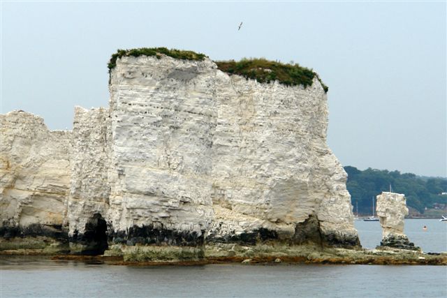
Brownsea Island is the largest Island within Poole Harbour. It is a former hill above river valleys from when sea levels were lower than they are today. It seperated to become an island during flooding from the Flandrian Trangression after the Pleistocene Ice Age ... and Poole Harbour was formed

The Pleistocene is the most well known of the Earth's Ice Ages. The ice sheets once covered all of Antartica, along with large areas of Europe, North and South America, and smaller areas of Asia. The glaciation of the Pleistocene consisted of several glacial advances followed by interglacial phases when the ice retreated and a relatively mild climate prevailed. Carbon-14 dating of fossils indicates that the last glacial period ended around 11,000 years ago